Counting Cows: Tracking Illegal Cattle Ranching From High-Resolution Satellite Imagery
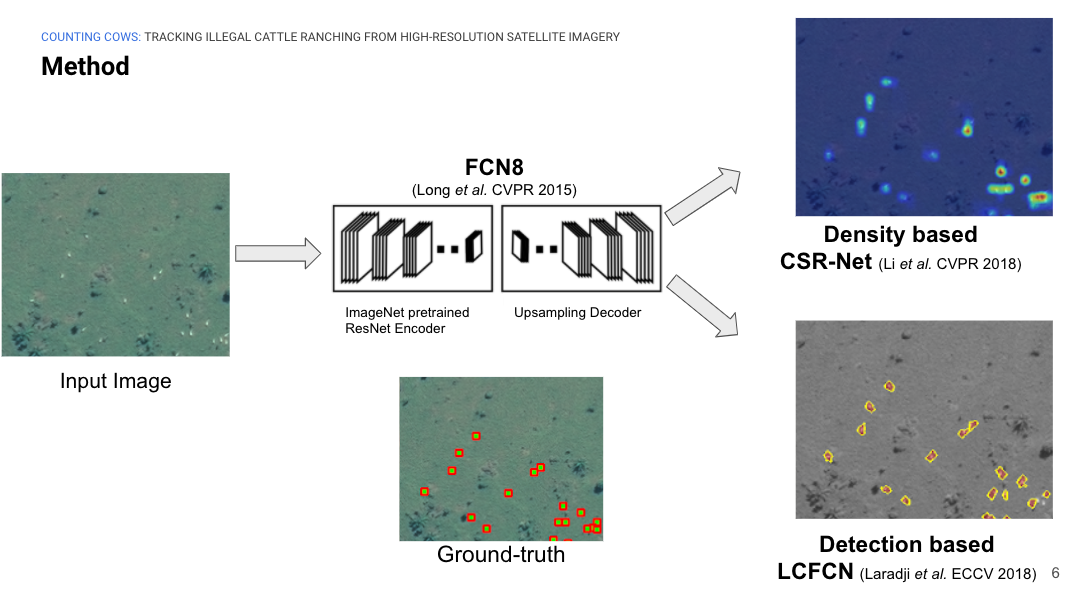
Cattle farming is responsible for 8.8\% of greenhouse gas emissions worldwide. In addition to the methane emitted due to their digestive process, the growing need for grazing areas is an important driver of deforestation. While some regulations are in place for preserving the Amazon against deforestation, these are being flouted in various ways, hence the need to scale and automate the monitoring of cattle ranching activities. Through a partnership with \textit{Global Witness}, we explore the feasibility of tracking and counting cattle at the continental scale from satellite imagery. With a license from Maxar Technologies, we obtained satellite imagery of the Amazon at 40cm resolution, and compiled a dataset of 903 images containing a total of 28498 cattle. Our experiments show promising results and highlight important directions for the next steps on both counting algorithms and the data collection process for solving such challenges. The code is available at \url{https://github.com/IssamLaradji/cownter_strike}.
PDF Abstract

