From Satellite Imagery to Disaster Insights
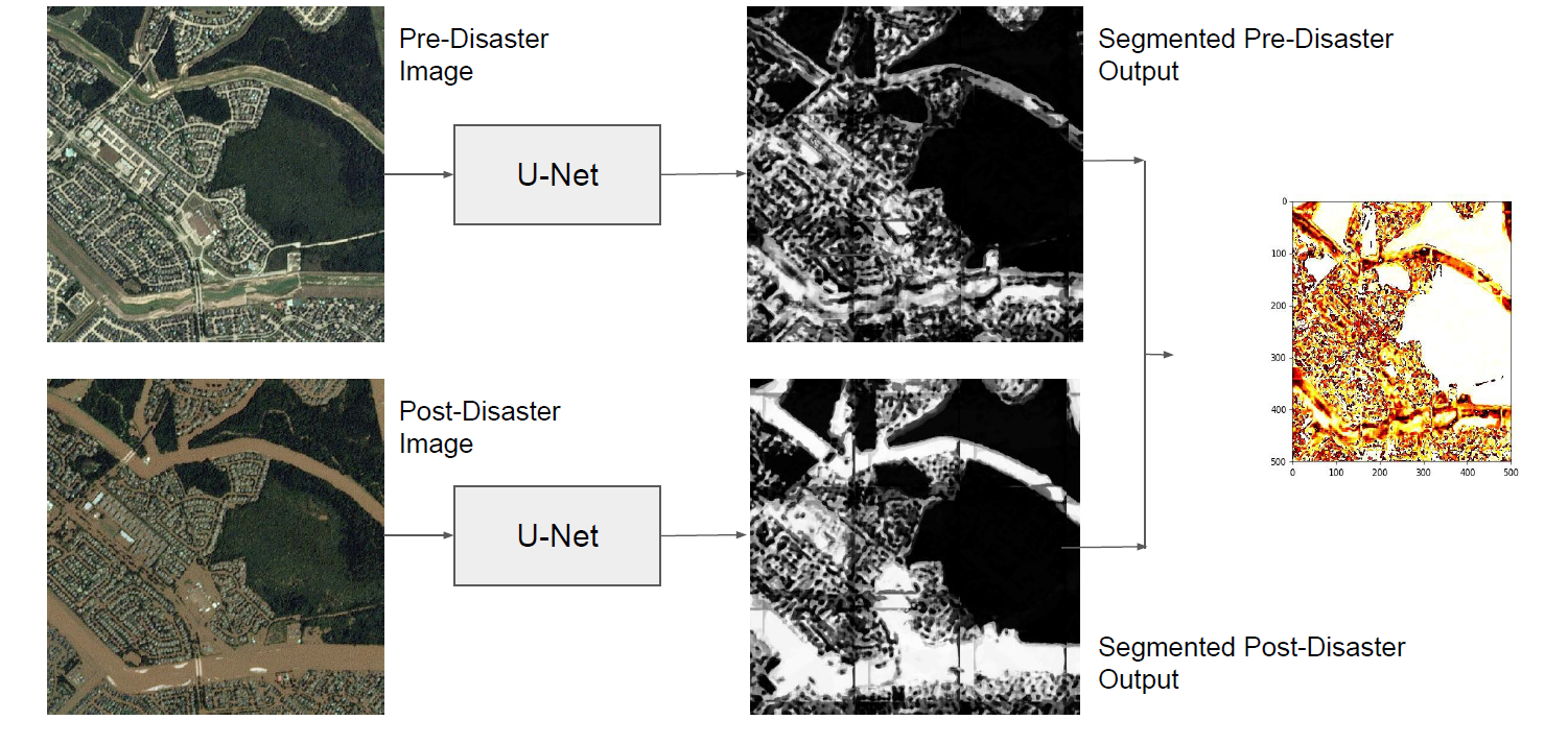
The use of satellite imagery has become increasingly popular for disaster monitoring and response. After a disaster, it is important to prioritize rescue operations, disaster response and coordinate relief efforts. These have to be carried out in a fast and efficient manner since resources are often limited in disaster-affected areas and it's extremely important to identify the areas of maximum damage. However, most of the existing disaster mapping efforts are manual which is time-consuming and often leads to erroneous results. In order to address these issues, we propose a framework for change detection using Convolutional Neural Networks (CNN) on satellite images which can then be thresholded and clustered together into grids to find areas which have been most severely affected by a disaster. We also present a novel metric called Disaster Impact Index (DII) and use it to quantify the impact of two natural disasters - the Hurricane Harvey flood and the Santa Rosa fire. Our framework achieves a top F1 score of 81.2% on the gridded flood dataset and 83.5% on the gridded fire dataset.
PDF Abstract


 DeepGlobe
