High-resolution land cover change from low-resolution labels: Simple baselines for the 2021 IEEE GRSS Data Fusion Contest
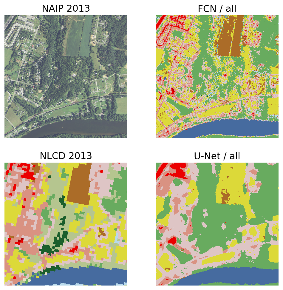
We present simple algorithms for land cover change detection in the 2021 IEEE GRSS Data Fusion Contest. The task of the contest is to create high-resolution (1m / pixel) land cover change maps of a study area in Maryland, USA, given multi-resolution imagery and label data. We study several baseline models for this task and discuss directions for further research. See https://dfc2021.blob.core.windows.net/competition-data/dfc2021_index.txt for the data and https://github.com/calebrob6/dfc2021-msd-baseline for an implementation of these baselines.
PDF Abstract
Tasks

Datasets
Add Datasets
introduced or used in this paper
Results from the Paper
Submit
results from this paper
to get state-of-the-art GitHub badges and help the
community compare results to other papers.
