Spatio-temporal crop classification of low-resolution satellite imagery with capsule layers and distributed attention
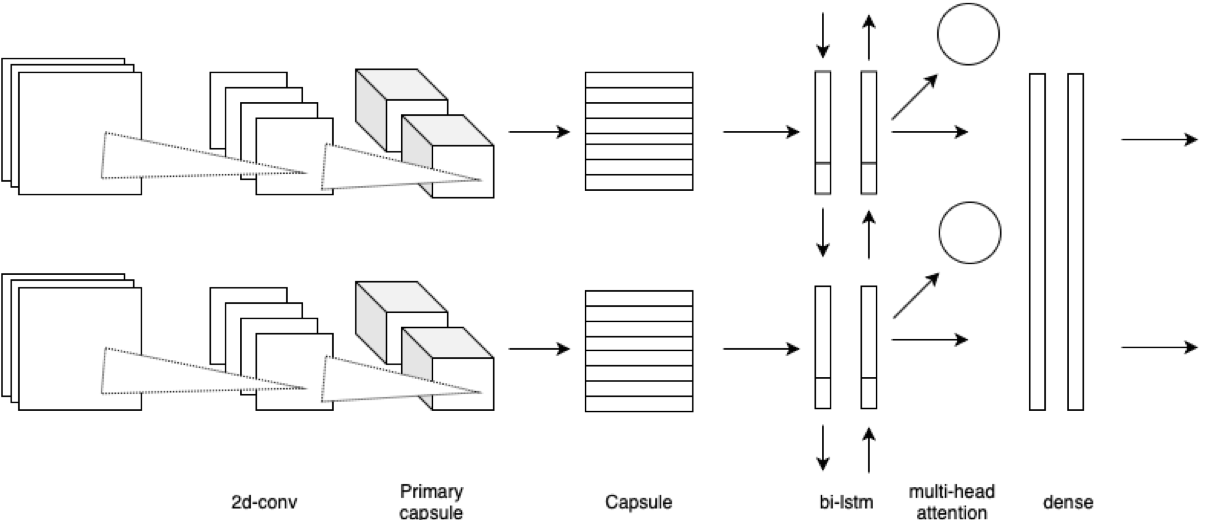
Land use classification of low resolution spatial imagery is one of the most extensively researched fields in remote sensing. Despite significant advancements in satellite technology, high resolution imagery lacks global coverage and can be prohibitively expensive to procure for extended time periods. Accurately classifying land use change without high resolution imagery offers the potential to monitor vital aspects of global development agenda including climate smart agriculture, drought resistant crops, and sustainable land management. Utilizing a combination of capsule layers and long-short term memory layers with distributed attention, the present paper achieves state-of-the-art accuracy on temporal crop type classification at a 30x30m resolution with Sentinel 2 imagery.
PDF Abstract


