Topo-boundary: A Benchmark Dataset on Topological Road-boundary Detection Using Aerial Images for Autonomous Driving
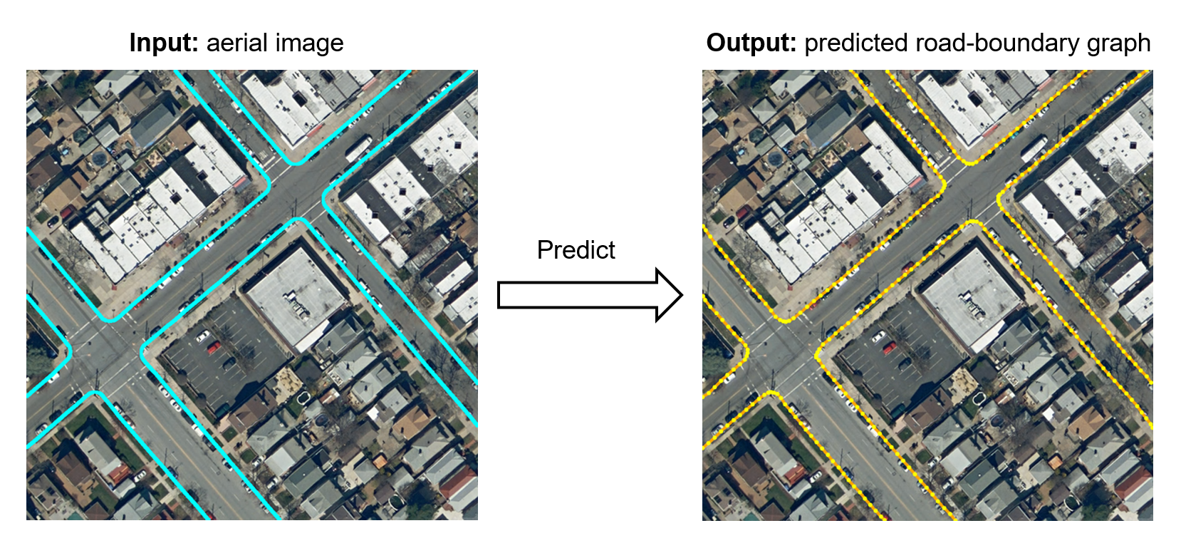
Road-boundary detection is important for autonomous driving. It can be used to constrain autonomous vehicles running on road areas to ensure driving safety. Compared with online road-boundary detection using on-vehicle cameras/Lidars, offline detection using aerial images could alleviate the severe occlusion issue. Moreover, the offline detection results can be directly employed to annotate high-definition (HD) maps. In recent years, deep-learning technologies have been used in offline detection. But there still lacks a publicly available dataset for this task, which hinders the research progress in this area. So in this paper, we propose a new benchmark dataset, named \textit{Topo-boundary}, for offline topological road-boundary detection. The dataset contains 25,295 $1000\times1000$-sized 4-channel aerial images. Each image is provided with 8 training labels for different sub-tasks. We also design a new entropy-based metric for connectivity evaluation, which could better handle noises or outliers. We implement and evaluate 3 segmentation-based baselines and 5 graph-based baselines using the dataset. We also propose a new imitation-learning-based baseline which is enhanced from our previous work. The superiority of our enhancement is demonstrated from the comparison. The dataset and our-implemented code for the baselines are available at \texttt{\url{https://tonyxuqaq.github.io/Topo-boundary/}}.
PDF Abstract


 Topo-boundary
 RoadTracer
