TTPLA: An Aerial-Image Dataset for Detection and Segmentation of Transmission Towers and Power Lines
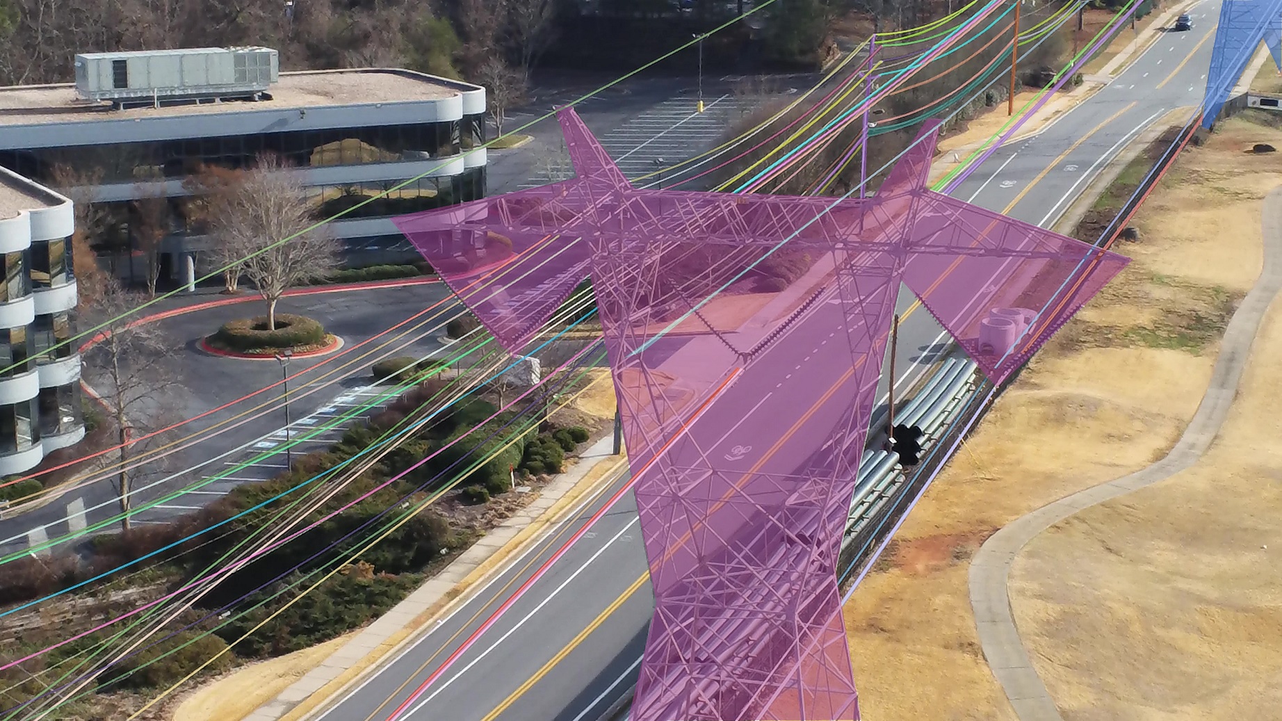
Accurate detection and segmentation of transmission towers~(TTs) and power lines~(PLs) from aerial images plays a key role in protecting power-grid security and low-altitude UAV safety. Meanwhile, aerial images of TTs and PLs pose a number of new challenges to the computer vision researchers who work on object detection and segmentation -- PLs are long and thin, and may show similar color as the background; TTs can be of various shapes and most likely made up of line structures of various sparsity; The background scene, lighting, and object sizes can vary significantly from one image to another. In this paper we collect and release a new TT/PL Aerial-image (TTPLA) dataset, consisting of 1,100 images with the resolution of 3,840$\times$2,160 pixels, as well as manually labeled 8,987 instances of TTs and PLs. We develop novel policies for collecting, annotating, and labeling the images in TTPLA. Different from other relevant datasets, TTPLA supports evaluation of instance segmentation, besides detection and semantic segmentation. To build a baseline for detection and segmentation tasks on TTPLA, we report the performance of several state-of-the-art deep learning models on our dataset. TTPLA dataset is publicly available at https://github.com/r3ab/ttpla_dataset
PDF Abstract


 TTPLA
TTPLA
 MS COCO
