Search Results for author:
Found 89 papers, 44 papers with code
DOTA: A Large-scale Dataset for Object Detection in Aerial Images
The fully annotated DOTA images contains $188, 282$ instances, each of which is labeled by an arbitrary (8 d. o. f.)
 Ranked #52 on
Object Detection In Aerial Images
on DOTA
(using extra training data)
Ranked #52 on
Object Detection In Aerial Images
on DOTA
(using extra training data)
Object Detection in Aerial Images: A Large-Scale Benchmark and Challenges
In this paper, we present a large-scale Dataset of Object deTection in Aerial images (DOTA) and comprehensive baselines for ODAI.
SAMRS: Scaling-up Remote Sensing Segmentation Dataset with Segment Anything Model
In this study, we leverage SAM and existing RS object detection datasets to develop an efficient pipeline for generating a large-scale RS segmentation dataset, dubbed SAMRS.

Change Detection in Multi-temporal VHR Images Based on Deep Siamese Multi-scale Convolutional Networks
Based on the unit two novel deep siamese convolutional neural networks, called as deep siamese multi-scale convolutional network (DSMS-CN) and deep siamese multi-scale fully convolutional network (DSMS-FCN), are designed for unsupervised and supervised change detection, respectively.
Unsupervised Change Detection in Multi-temporal VHR Images Based on Deep Kernel PCA Convolutional Mapping Network
Based on the KPCA convolution, an unsupervised deep siamese KPCA convolutional mapping network (KPCA-MNet) is designed for binary and multi-class change detection.

Advancing Plain Vision Transformer Towards Remote Sensing Foundation Model
Large-scale vision foundation models have made significant progress in visual tasks on natural images, with vision transformers being the primary choice due to their good scalability and representation ability.
 Ranked #1 on
Aerial Scene Classification
on AID (50% as trainset)
Ranked #1 on
Aerial Scene Classification
on AID (50% as trainset)
Change is Everywhere: Single-Temporal Supervised Object Change Detection in Remote Sensing Imagery
For high spatial resolution (HSR) remote sensing images, bitemporal supervised learning always dominates change detection using many pairwise labeled bitemporal images.
 Ranked #12 on
Change Detection
on LEVIR-CD
Ranked #12 on
Change Detection
on LEVIR-CD
 Building change detection for remote sensing images
Change detection for remote sensing images
+1
Building change detection for remote sensing images
Change detection for remote sensing images
+1
Learning Attraction Field Representation for Robust Line Segment Detection
In experiments, our method is tested on the WireFrame dataset and the YorkUrban dataset with state-of-the-art performance obtained.
Holistically-Attracted Wireframe Parsing
For computing line segment proposals, a novel exact dual representation is proposed which exploits a parsimonious geometric reparameterization for line segments and forms a holistic 4-dimensional attraction field map for an input image.
 Ranked #4 on
Line Segment Detection
on York Urban Dataset
Ranked #4 on
Line Segment Detection
on York Urban Dataset
Holistically-Attracted Wireframe Parsing: From Supervised to Self-Supervised Learning
This article presents Holistically-Attracted Wireframe Parsing (HAWP), a method for geometric analysis of 2D images containing wireframes formed by line segments and junctions.

LUAI Challenge 2021 on Learning to Understand Aerial Images
This report summarizes the results of Learning to Understand Aerial Images (LUAI) 2021 challenge held on ICCV 2021, which focuses on object detection and semantic segmentation in aerial images.
Remote Sensing ChatGPT: Solving Remote Sensing Tasks with ChatGPT and Visual Models
Recently, the flourishing large language models(LLM), especially ChatGPT, have shown exceptional performance in language understanding, reasoning, and interaction, attracting users and researchers from multiple fields and domains.
FPGA: Fast Patch-Free Global Learning Framework for Fully End-to-End Hyperspectral Image Classification
In this paper, a fast patch-free global learning (FPGA) framework is proposed for HSI classification.
 Ranked #1 on
Hyperspectral Image Classification
on Pavia University
(OA@200 metric)
Ranked #1 on
Hyperspectral Image Classification
on Pavia University
(OA@200 metric)


EDiffSR: An Efficient Diffusion Probabilistic Model for Remote Sensing Image Super-Resolution
Recently, convolutional networks have achieved remarkable development in remote sensing image Super-Resoltuion (SR) by minimizing the regression objectives, e. g., MSE loss.

MTP: Advancing Remote Sensing Foundation Model via Multi-Task Pretraining
However, transferring the pretrained models to downstream tasks may encounter task discrepancy due to their formulation of pretraining as image classification or object discrimination tasks.
 Ranked #1 on
Semantic Segmentation
on SpaceNet 1
(using extra training data)
Ranked #1 on
Semantic Segmentation
on SpaceNet 1
(using extra training data)
Aerial Scene Classification
Building change detection for remote sensing images
+13
Unsupervised Deep Slow Feature Analysis for Change Detection in Multi-Temporal Remote Sensing Images
In recent years, deep network has shown its brilliant performance in many fields including feature extraction and projection.
One-Step Detection Paradigm for Hyperspectral Anomaly Detection via Spectral Deviation Relationship Learning
In this paper, an unsupervised transferred direct detection (TDD) model is proposed, which is optimized directly for the anomaly detection task (one-step paradigm) and has transferability.

Fully Convolutional Change Detection Framework with Generative Adversarial Network for Unsupervised, Weakly Supervised and Regional Supervised Change Detection
Deep learning for change detection is one of the current hot topics in the field of remote sensing.
Hyperspectral Image Denoising Employing a Spatial-Spectral Deep Residual Convolutional Neural Network
Hyperspectral image (HSI) denoising is a crucial preprocessing procedure to improve the performance of the subsequent HSI interpretation and applications.


Super-resolution-based Change Detection Network with Stacked Attention Module for Images with Different Resolutions
The experimental results demonstrate the superiority of the proposed method, which not only outperforms all baselines -with the highest F1 scores of 87. 40% on the building change detection dataset and 92. 94% on the change detection dataset -but also obtains the best accuracies on experiments performed with images having a 4x and 8x resolution difference.

Hyperspectral image classification via a random patches network
Due to the remarkable achievements obtained by deep learning methods in the fields of computer vision, an increasing number of researches have been made to apply these powerful tools into hyperspectral image (HSI) classification.


A Spectral-Spatial-Dependent Global Learning Framework for Insufficient and Imbalanced Hyperspectral Image Classification
However, FPGA has difficulty extracting the most discriminative features when the sample data is imbalanced.
 Ranked #1 on
Hyperspectral Image Classification
on Indian Pines
(Kappa metric, using extra
training data)
Ranked #1 on
Hyperspectral Image Classification
on Indian Pines
(Kappa metric, using extra
training data)

ESCNet: An End-to-End Superpixel-Enhanced Change Detection Network for Very-High-Resolution Remote Sensing Images
In this article, we propose an end-to-end superpixel-enhanced CD network (ESCNet) for VHR images, which combines differentiable superpixel segmentation and a deep convolutional neural network (DCNN).
 Ranked #14 on
Change Detection
on CDD Dataset (season-varying)
Ranked #14 on
Change Detection
on CDD Dataset (season-varying)
 Change Detection
Change detection for remote sensing images
+2
Change Detection
Change detection for remote sensing images
+2
Hyperspectral Anomaly Change Detection Based on Auto-encoder
In the ACDA model, two systematic auto-encoder (AE) networks are deployed to construct two predictors from two directions.
Scalable Multi-Temporal Remote Sensing Change Data Generation via Simulating Stochastic Change Process
To solve these two problems, we present the change generator (Changen), a GAN-based GPCM, enabling controllable object change data generation, including customizable object property, and change event.
 Ranked #1 on
Change Detection
on S2Looking
Ranked #1 on
Change Detection
on S2Looking
Spectral-Spatial Global Graph Reasoning for Hyperspectral Image Classification
To tackle these problems, in this paper, different from previous approaches, we perform the superpixel generation on intermediate features during network training to adaptively produce homogeneous regions, obtain graph structures, and further generate spatial descriptors, which are served as graph nodes.
DCN-T: Dual Context Network with Transformer for Hyperspectral Image Classification
Hyperspectral image (HSI) classification is challenging due to spatial variability caused by complex imaging conditions.

AID: A Benchmark Dataset for Performance Evaluation of Aerial Scene Classification
The goal of AID is to advance the state-of-the-arts in scene classification of remote sensing images.
Non-local Meets Global: An Iterative Paradigm for Hyperspectral Image Restoration
Non-local low-rank tensor approximation has been developed as a state-of-the-art method for hyperspectral image (HSI) restoration, which includes the tasks of denoising, compressed HSI reconstruction and inpainting.

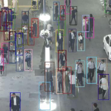
Learning Local-Global Contextual Adaptation for Multi-Person Pose Estimation
This paper studies the problem of multi-person pose estimation in a bottom-up fashion.

Building Extraction from Remote Sensing Images via an Uncertainty-Aware Network
Building extraction aims to segment building pixels from remote sensing images and plays an essential role in many applications, such as city planning and urban dynamic monitoring.
 Ranked #1 on
Semantic Segmentation
on INRIA Aerial Image Labeling
Ranked #1 on
Semantic Segmentation
on INRIA Aerial Image Labeling
Extracting Buildings In Remote Sensing Images
 Semantic Segmentation
Deep Blind Super-Resolution for Satellite Video
Therefore, this paper proposes a practical Blind SVSR algorithm (BSVSR) to explore more sharp cues by considering the pixel-wise blur levels in a coarse-to-fine manner.

Local-Global Temporal Difference Learning for Satellite Video Super-Resolution
To explore the global dependency in the entire frame sequence, a Long-term Temporal Difference Module (L-TDM) is proposed, where the differences between forward and backward segments are incorporated and activated to guide the modulation of the temporal feature, leading to a holistic global compensation.

Robust Self-Ensembling Network for Hyperspectral Image Classification
Since the collection of pixel-level annotations for HSI is laborious and time-consuming, developing algorithms that can yield good performance in the small sample size situation is of great significance.
On Creating Benchmark Dataset for Aerial Image Interpretation: Reviews, Guidances and Million-AID
After reviewing existing benchmark datasets in the research community of RS image interpretation, this article discusses the problem of how to efficiently prepare a suitable benchmark dataset for RS image interpretation.

Hybrid Noise Removal in Hyperspectral Imagery With a Spatial-Spectral Gradient Network
The existence of hybrid noise in hyperspectral images (HSIs) severely degrades the data quality, reduces the interpretation accuracy of HSIs, and restricts the subsequent HSIs applications.
Deep learning in remote sensing: a review
In this article, we analyze the challenges of using deep learning for remote sensing data analysis, review the recent advances, and provide resources to make deep learning in remote sensing ridiculously simple to start with.
HKNAS: Classification of Hyperspectral Imagery Based on Hyper Kernel Neural Architecture Search
Recent neural architecture search (NAS) based approaches have made great progress in hyperspectral image (HSI) classification tasks.

Semantic Change Detection with Asymmetric Siamese Networks
Given two multi-temporal aerial images, semantic change detection aims to locate the land-cover variations and identify their change types with pixel-wise boundaries.
Self-Ensembling GAN for Cross-Domain Semantic Segmentation
In SE-GAN, a teacher network and a student network constitute a self-ensembling model for generating semantic segmentation maps, which together with a discriminator, forms a GAN.
DeepCL: Deep Change Feature Learning on Remote Sensing Images in the Metric Space
To address these issues, we complement the strong temporal modeling ability of metric learning with the prominent fitting ability of segmentation and propose a deep change feature learning (DeepCL) framework for robust and explainable CD.
A Unified Remote Sensing Anomaly Detector Across Modalities and Scenes via Deviation Relationship Learning
Firstly, we reformulate the anomaly detection task as an undirected bilayer graph based on the deviation relationship, where the anomaly score is modeled as the conditional probability, given the pattern of the background and normal objects.
Cross-Scope Spatial-Spectral Information Aggregation for Hyperspectral Image Super-Resolution
The prevailing transformer-based methods have not adequately captured the long-range dependencies in both spectral and spatial dimensions.
Accurate Building Detection in VHR Remote Sensing Images using Geometric Saliency
This paper aims to address the problem of detecting buildings from remote sensing images with very high resolution (VHR).
Large-scale Land Cover Classification in GaoFen-2 Satellite Imagery
Many significant applications need land cover information of remote sensing images that are acquired from different areas and times, such as change detection and disaster monitoring.
Recent advances and opportunities in scene classification of aerial images with deep models
Scene classification is a fundamental task in interpretation of remote sensing images, and has become an active research topic in remote sensing community due to its important role in a wide range of applications.
AID++: An Updated Version of AID on Scene Classification
Aerial image scene classification is a fundamental problem for understanding high-resolution remote sensing images and has become an active research task in the field of remote sensing due to its important role in a wide range of applications.
Object Tracking in Satellite Videos Based on a Multi-Frame Optical Flow Tracker
Object tracking is a hot topic in computer vision.
Learning the Synthesizability of Dynamic Texture Samples
In this paper, we investigate the synthesizability of dynamic texture samples: {\em given a dynamic texture sample, how synthesizable it is by using EDTS, and which EDTS method is the most suitable to synthesize it?}
A Multi-Scale and Multi-Depth Convolutional Neural Network for Remote Sensing Imagery Pan-Sharpening
Pan-sharpening is a fundamental and significant task in the field of remote sensing imagery processing, in which high-resolution spatial details from panchromatic images are employed to enhance the spatial resolution of multi-spectral (MS) images.
Image Stitching by Line-guided Local Warping with Global Similarity Constraint
On one hand, the line features are integrated into a local warping model through a designed weight function.

Anisotropic-Scale Junction Detection and Matching for Indoor Images
This paper presents a novel approach to junction detection and characterization that exploits the locally anisotropic geometries of a junction and estimates the scales of these geometries using an \emph{a contrario} model.
Exploiting Deep Features for Remote Sensing Image Retrieval: A Systematic Investigation
Over the past two decades, a large amount of research on this task has been carried out, which mainly focuses on the following three core issues: feature extraction, similarity metric and relevance feedback.

Boosting the accuracy of multi-spectral image pan-sharpening by learning a deep residual network
In the field of fusing multi-spectral and panchromatic images (Pan-sharpening), the impressive effectiveness of deep neural networks has been recently employed to overcome the drawbacks of traditional linear models and boost the fusing accuracy.
A multi-task convolutional neural network for mega-city analysis using very high resolution satellite imagery and geospatial data
For the second target, a novel CNN-based universal framework is proposed to process the VHR satellite images and generate the land-use, urban density, and population distribution maps.
Texture Characterization by Using Shape Co-occurrence Patterns
In contrast with existing works, the proposed method not only inherits the strong ability to depict geometrical aspects of textures and the high robustness to variations of imaging conditions from the shape-based method, but also provides a flexible way to consider shape relationships and to compute high-order statistics on the tree.
Multi-feature combined cloud and cloud shadow detection in GaoFen-1 wide field of view imagery
In this paper, an automatic multi-feature combined (MFC) method is proposed for cloud and cloud shadow detection in GF-1 WFV imagery.
A Spatial and Temporal Non-Local Filter Based Data Fusion
The spatiotemporal data fusion technique is considered as a cost-effective way to obtain remote sensing data with both high spatial resolution and high temporal frequency, by blending observations from multiple sensors with different advantages or characteristics.
Image stitching with perspective-preserving warping
Image stitching algorithms often adopt the global transformation, such as homography, and work well for planar scenes or parallax free camera motions.
Dense v.s. Sparse: A Comparative Study of Sampling Analysis in Scene Classification of High-Resolution Remote Sensing Imagery
The experimental results on two commonly used datasets show that dense sampling has the best performance among all the strategies but with high spatial and computational complexity, random sampling gives better or comparable results than other sparse sampling methods, like the sophisticated multi-scale key-point operators and the saliency-based methods which are intensively studied and commonly used recently.
Land-Cover Classification with High-Resolution Remote Sensing Images Using Transferable Deep Models
The main idea is to rely on deep neural networks for presenting the contextual information contained in different types of land-covers and propose a pseudo-labeling and sample selection scheme for improving the transferability of deep models.

Spatial-Spectral Fusion by Combining Deep Learning and Variation Model
In the field of spatial-spectral fusion, the model-based method and the deep learning (DL)-based method are state-of-the-art.
Oblique Stripe Removal in Remote Sensing Images via Oriented Variation
Destriping is a classical problem in remote sensing image processing.
Mini-Unmanned Aerial Vehicle-Based Remote Sensing: Techniques, Applications, and Prospects
We hope this paper will provide remote-sensing researchers an overall picture of recent UAV-based remote sensing developments and help guide the further research on this topic.
Robust and Discriminative Labeling for Multi-label Active Learning Based on Maximum Correntropy Criterion
Meanwhile, it is also hard to build a good model without diagnosing discriminative labels.

Exploring Representativeness and Informativeness for Active Learning
Then can we find a way to fuse the two active sampling criteria without any assumption on data?
Learning Regional Attraction for Line Segment Detection
Given a line segment map, the proposed regional attraction first establishes the relationship between line segments and regions in the image lattice.
DSDANet: Deep Siamese Domain Adaptation Convolutional Neural Network for Cross-domain Change Detection
By optimizing the network parameters and kernel coefficients with the source labeled data and target unlabeled data, DSDANet can learn transferrable feature representation that can bridge the discrepancy between two domains.
An Investigation of Traffic Density Changes inside Wuhan during the COVID-19 Epidemic with GF-2 Time-Series Images
The significant reduction and recovery of traffic density indicates that the lockdown policy in Wuhan show effectiveness in controlling human transmission inside the city, and the city returned to normal after lockdown lift.
Few-Shot Hyperspectral Image Classification With Unknown Classes Using Multitask Deep Learning
Current hyperspectral image classification assumes that a predefined classification system is closed and complete, and there are no unknown or novel classes in the unseen data.
Spectral Response Function Guided Deep Optimization-driven Network for Spectral Super-resolution
Hyperspectral images are crucial for many research works.

Long time-series NDVI reconstruction in cloud-prone regions via spatio-temporal tensor completion
The applications of Normalized Difference Vegetation Index (NDVI) time-series data are inevitably hampered by cloud-induced gaps and noise.

Transportation Density Reduction Caused by City Lockdowns Across the World during the COVID-19 Epidemic: From the View of High-resolution Remote Sensing Imagery
Considering that public transportation was mostly reduced or even forbidden, our results indicate that city lockdown policies are effective at limiting human transmission within cities.
Interpretable Hyperspectral AI: When Non-Convex Modeling meets Hyperspectral Remote Sensing
Hyperspectral imaging, also known as image spectrometry, is a landmark technique in geoscience and remote sensing (RS).
Coupling Model-Driven and Data-Driven Methods for Remote Sensing Image Restoration and Fusion
In this paper, we systematically investigate the coupling of model-driven and data-driven methods, which has rarely been considered in the remote sensing image restoration and fusion communities.
An Integrated Framework for the Heterogeneous Spatio-Spectral-Temporal Fusion of Remote Sensing Images
Images from many remote sensing satellites, including MODIS, Landsat-8, Sentinel-1, and Sentinel-2, are utilized in the experiments.
Binary Change Guided Hyperspectral Multiclass Change Detection
In this study, we proposed an unsupervised Binary Change Guided hyperspectral multiclass change detection Network (BCG-Net) for HMCD, which aims at boosting the multiclass change detection result and unmixing result with the mature binary change detection approaches.
Hidden Path Selection Network for Semantic Segmentation of Remote Sensing Images
Targeting at depicting land covers with pixel-wise semantic categories, semantic segmentation in remote sensing images needs to portray diverse distributions over vast geographical locations, which is difficult to be achieved by the homogeneous pixel-wise forward paths in the architectures of existing deep models.
Aerial Scene Parsing: From Tile-level Scene Classification to Pixel-wise Semantic Labeling
Finally, we perform ASP by unifying the tile-level scene classification and object-based image analysis to achieve pixel-wise semantic labeling.
HyperNet: Self-Supervised Hyperspectral Spatial-Spectral Feature Understanding Network for Hyperspectral Change Detection
Only the positive samples at the same location of bi-temporal HSIs are created and forced to be aligned, aiming at learning the spectral difference-invariant features.
DDS2M: Self-Supervised Denoising Diffusion Spatio-Spectral Model for Hyperspectral Image Restoration
This is especially inappropriate for data-starved hyperspectral image (HSI) restoration.
GlobalMind: Global Multi-head Interactive Self-attention Network for Hyperspectral Change Detection
High spectral resolution imagery of the Earth's surface enables users to monitor changes over time in fine-grained scale, playing an increasingly important role in agriculture, defense, and emergency response.
Revolutionizing Agrifood Systems with Artificial Intelligence: A Survey
With the world population rapidly increasing, transforming our agrifood systems to be more productive, efficient, safe, and sustainable is crucial to mitigate potential food shortages.
Building-road Collaborative Extraction from Remotely Sensed Images via Cross-Interaction
Compared with many existing methods that train each task individually, the proposed collaborative extraction method can utilize the complementary advantages between buildings and roads by the proposed inter-task and inter-scale feature interactions, and automatically select the optimal reception field for different tasks.
Expediting Building Footprint Extraction from High-resolution Remote Sensing Images via progressive lenient supervision
The efficacy of building footprint segmentation from remotely sensed images has been hindered by model transfer effectiveness.
SAAN: Similarity-aware attention flow network for change detection with VHR remote sensing images
These CD methods, however, still perform far from satisfactorily as we observe that 1) deep encoder layers focus on irrelevant background regions and 2) the models' confidence in the change regions is inconsistent at different decoder stages.
FarSeg++: Foreground-Aware Relation Network for Geospatial Object Segmentation in High Spatial Resolution Remote Sensing Imagery
Generic semantic segmentation methods mainly focus on the scale variation in natural scenarios.

Learning transformer-based heterogeneously salient graph representation for multimodal fusion classification of hyperspectral image and LiDAR data
Data collected by different modalities can provide a wealth of complementary information, such as hyperspectral image (HSI) to offer rich spectral-spatial properties, synthetic aperture radar (SAR) to provide structural information about the Earth's surface, and light detection and ranging (LiDAR) to cover altitude information about ground elevation.
Segment Any Change
Visual foundation models have achieved remarkable results in zero-shot image classification and segmentation, but zero-shot change detection remains an open problem.
