An Artificial Intelligence Dataset for Solar Energy Locations in India
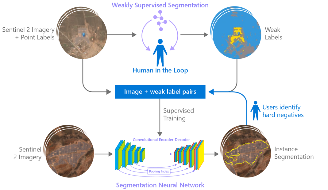
Rapid development of renewable energy sources, particularly solar photovoltaics (PV), is critical to mitigate climate change. As a result, India has set ambitious goals to install 500 gigawatts of solar energy capacity by 2030. Given the large footprint projected to meet renewables energy targets, the potential for land use conflicts over environmental values is high. To expedite development of solar energy, land use planners will need access to up-to-date and accurate geo-spatial information of PV infrastructure. In this work, we developed a spatially explicit machine learning model to map utility-scale solar projects across India using freely available satellite imagery with a mean accuracy of 92%. Our model predictions were validated by human experts to obtain a dataset of 1363 solar PV farms. Using this dataset, we measure the solar footprint across India and quantified the degree of landcover modification associated with the development of PV infrastructure. Our analysis indicates that over 74% of solar development In India was built on landcover types that have natural ecosystem preservation, or agricultural value.
PDF Abstract
