Rapid Deforestation and Burned Area Detection using Deep Multimodal Learning on Satellite Imagery
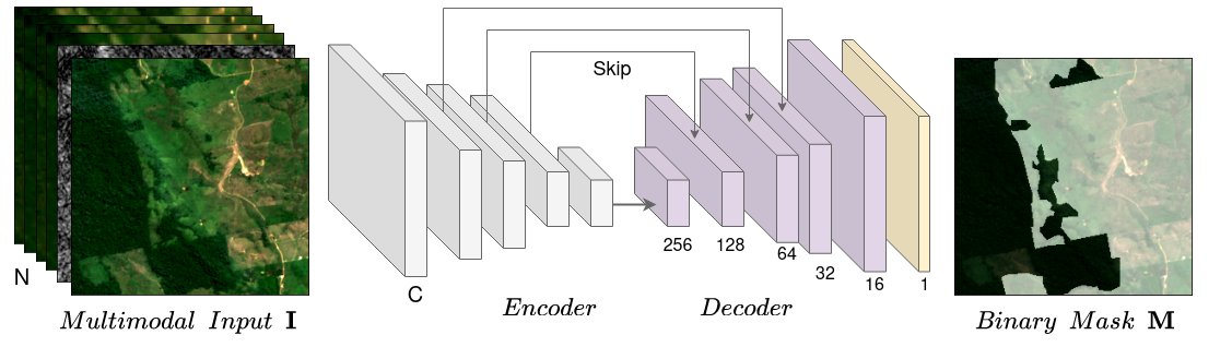
Deforestation estimation and fire detection in the Amazon forest poses a significant challenge due to the vast size of the area and the limited accessibility. However, these are crucial problems that lead to severe environmental consequences, including climate change, global warming, and biodiversity loss. To effectively address this problem, multimodal satellite imagery and remote sensing offer a promising solution for estimating deforestation and detecting wildfire in the Amazonia region. This research paper introduces a new curated dataset and a deep learning-based approach to solve these problems using convolutional neural networks (CNNs) and comprehensive data processing techniques. Our dataset includes curated images and diverse channel bands from Sentinel, Landsat, VIIRS, and MODIS satellites. We design the dataset considering different spatial and temporal resolution requirements. Our method successfully achieves high-precision deforestation estimation and burned area detection on unseen images from the region. Our code, models and dataset are open source: https://github.com/h2oai/cvpr-multiearth-deforestation-segmentation
PDF Abstract
