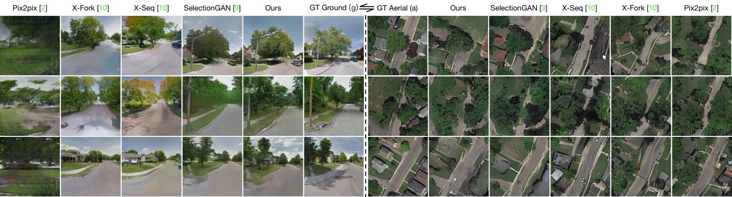
The Dayton dataset is a dataset for ground-to-aerial (or aerial-to-ground) image translation, or cross-view image synthesis. It contains images of road views and aerial views of roads. There are 76,048 images in total and the train/test split is 55,000/21,048. The images in the original dataset have 354×354 resolution.
Source: Multi-Channel Attention Selection GANs for Guided Image-to-Image TranslationBenchmarks
| Trend | Task | Dataset Variant | Best Model | Paper | Code |
|---|---|---|---|---|---|
|
|
Dayton (256×256) - aerial-to-ground
|
SelectionGAN
|
|||
|
|
Dayton (64×64) - aerial-to-ground
|
SelectionGAN
|
|||
|
|
Dayton (64x64) - ground-to-aerial
|
SelectionGAN
|
|||
|
|
Dayton (256×256) - ground-to-aerial
|
SelectionGAN
|
Papers
| Paper | Code | Results | Date | Stars |
|---|


