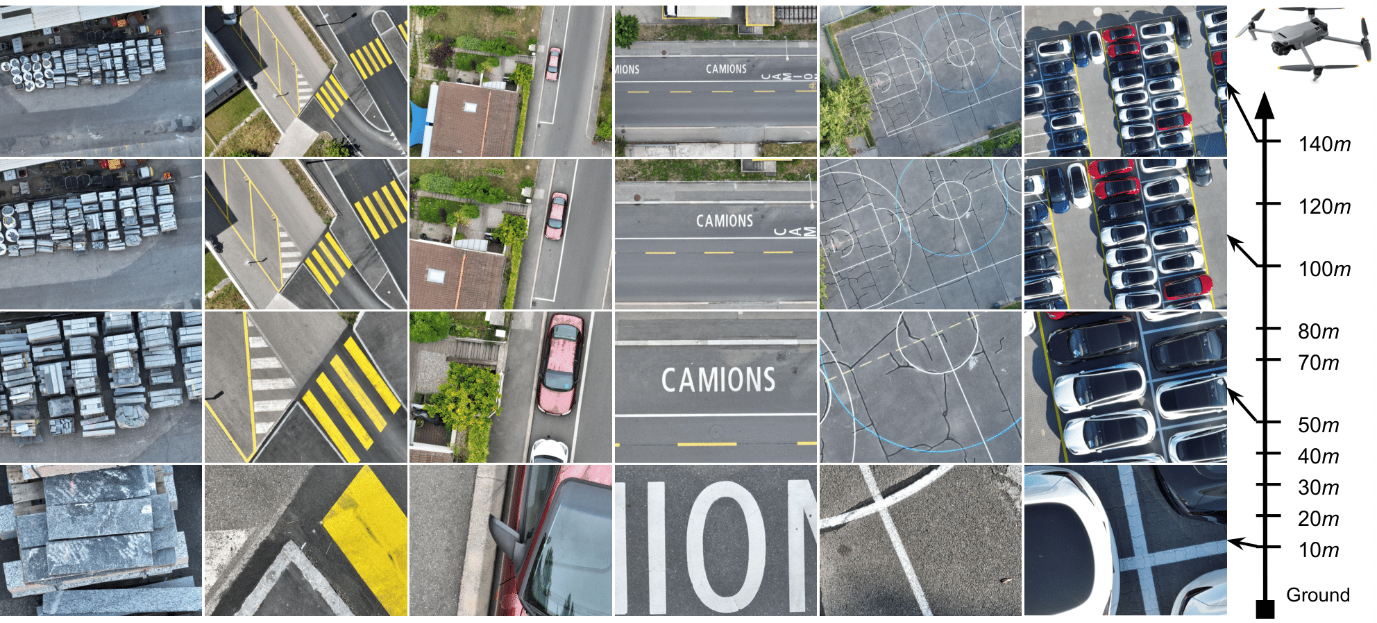
DSR: Towards Drone Image Super-Resolution
Despite achieving remarkable progress in recent years, single-image super-resolution methods are developed with several limitations. Specifically, they are trained on fixed content domains with certain degradations (whether synthetic or real). The priors they learn are prone to overfitting the training configuration. Therefore, the generalization to novel domains such as drone top view data, and across altitudes, is currently unknown. Nonetheless, pairing drones with proper image super-resolution is of great value. It would enable drones to fly higher covering larger fields of view, while maintaining a high image quality. To answer these questions and pave the way towards drone image super-resolution, we explore this application with particular focus on the single-image case. We propose a novel drone image dataset, with scenes captured at low and high resolutions, and across a span of altitudes. Our results show that off-the-shelf state-of-the-art networks witness a significant drop in performance on this different domain. We additionally show that simple fine-tuning, and incorporating altitude awareness into the network's architecture, both improve the reconstruction performance.
PDF Abstract


 Urban100
 Set5
Set5
 UAVDT
UAVDT
