A Surface Geometry Model for LiDAR Depth Completion
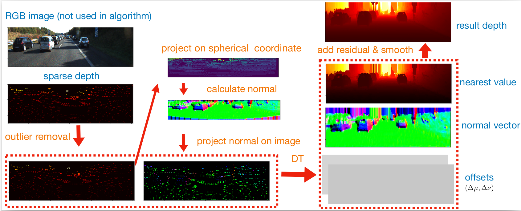
LiDAR depth completion is a task that predicts depth values for every pixel on the corresponding camera frame, although only sparse LiDAR points are available. Most of the existing state-of-the-art solutions are based on deep neural networks, which need a large amount of data and heavy computations for training the models. In this letter, a novel non-learning depth completion method is proposed by exploiting the local surface geometry that is enhanced by an outlier removal algorithm. The proposed surface geometry model is inspired by the observation that most pixels with unknown depth have a nearby LiDAR point. Therefore, it is assumed those pixels share the same surface with the nearest LiDAR point, and their respective depth can be estimated as the nearest LiDAR depth value plus a residual error. The residual error is calculated by using a derived equation with several physical parameters as input, including the known camera intrinsic parameters, estimated normal vector, and offset distance on the image plane. The proposed method is further enhanced by an outlier removal algorithm that is designed to remove incorrectly mapped LiDAR points from occluded regions. On KITTI dataset, the proposed solution achieves the best error performance among all existing non-learning methods and is comparable to the best self-supervised learning method and some supervised learning methods. Moreover, since outlier points from occluded regions is a commonly existing problem, the proposed outlier removal algorithm is a general preprocessing step that is applicable to many robotic systems with both camera and LiDAR sensors.
PDF Abstract


 KITTI
KITTI
