Search Results for author:
Found 12 papers, 8 papers with code
LetsGo: Large-Scale Garage Modeling and Rendering via LiDAR-Assisted Gaussian Primitives
We demonstrate that the collected LiDAR point cloud by the Polar device enhances a suite of 3D Gaussian splatting algorithms for garage scene modeling and rendering.


Learning Dense Flow Field for Highly-accurate Cross-view Camera Localization
We propose a novel end-to-end approach that leverages the learning of dense pixel-wise flow fields in pairs of ground and satellite images to calculate the camera pose.


Boosting 3-DoF Ground-to-Satellite Camera Localization Accuracy via Geometry-Guided Cross-View Transformer
In this paper, we propose a method to increase the accuracy of a ground camera's location and orientation by estimating the relative rotation and translation between the ground-level image and its matched/retrieved satellite image.

CVLNet: Cross-View Semantic Correspondence Learning for Video-based Camera Localization
The critical challenge of this task is to learn a powerful global feature descriptor for the sequential ground-view images while considering its domain alignment with reference satellite images.
Beyond Cross-view Image Retrieval: Highly Accurate Vehicle Localization Using Satellite Image
This paper addresses the problem of vehicle-mounted camera localization by matching a ground-level image with an overhead-view satellite map.
Accurate 3-DoF Camera Geo-Localization via Ground-to-Satellite Image Matching
We address the problem of ground-to-satellite image geo-localization, that is, estimating the camera latitude, longitude and orientation (azimuth angle) by matching a query image captured at the ground level against a large-scale database with geotagged satellite images.
Neural Plenoptic Sampling: Capture Light-field from Imaginary Eyes
It encodes a complete light-field (\ie, lumigraph) therefore allows one to freely roam in the space and view the scene from any location in any direction.
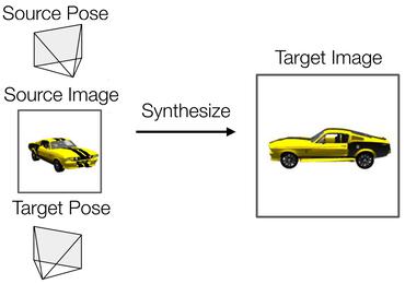
Self-Supervised Visibility Learning for Novel View Synthesis
We then warp and aggregate source view pixels to synthesize a novel view based on the estimated source-view visibility and target-view depth.
Geometry-Guided Street-View Panorama Synthesis from Satellite Imagery
Specifically, we observe that when a 3D point in the real world is visible in both views, there is a deterministic mapping between the projected points in the two-view images given the height information of this 3D point.

Where am I looking at? Joint Location and Orientation Estimation by Cross-View Matching
Cross-view geo-localization is the problem of estimating the position and orientation (latitude, longitude and azimuth angle) of a camera at ground level given a large-scale database of geo-tagged aerial (e. g., satellite) images.
Spatial-Aware Feature Aggregation for Image based Cross-View Geo-Localization
The first step is to apply a regular polar transform to warp an aerial image such that its domain is closer to that of a ground-view panorama.
 Ranked #4 on
Image-Based Localization
on VIGOR Cross Area
Ranked #4 on
Image-Based Localization
on VIGOR Cross Area
Optimal Feature Transport for Cross-View Image Geo-Localization
This paper proposes a novel Cross-View Feature Transport (CVFT) technique to explicitly establish cross-view domain transfer that facilitates feature alignment between ground and aerial images.

